Catalogue de données
BD TOPAGE - BASSINS HYDROGRAPHIQUE - France Métropole 2019
Jeu de données des bassins hydrographiques de France métropolitaine BD Topage® version 2019
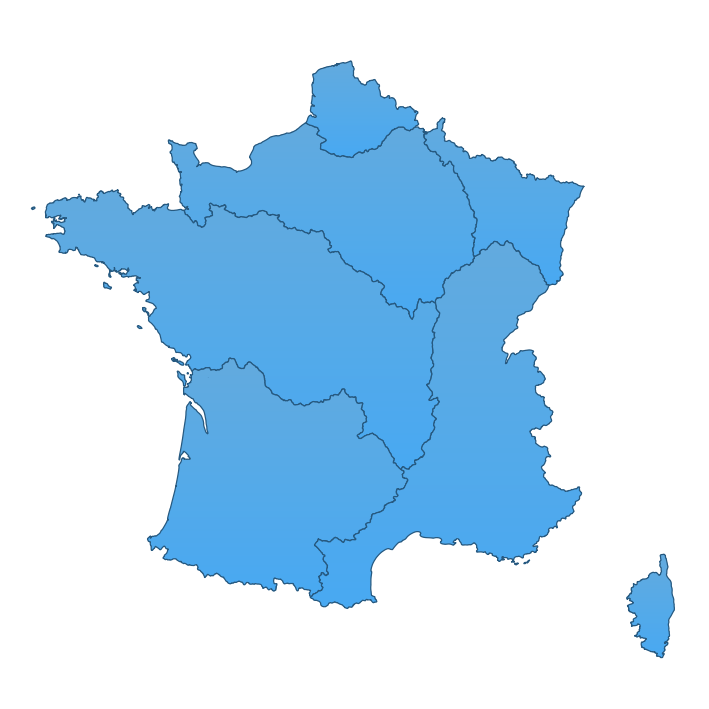
La France métropolitaine est découpée en 7 grands bassins versants, dénommés circonscription hydrographique de bassin. Il s’agit :
- du bassin Artois-Picardie,
- du bassin Rhin-Meuse,
- du bassin Seine-Normandie,
- du bassin Loire-Bretagne,
- du bassin Adour-Garonne.
- du bassin Rhône-Méditerranée,
- du bassin Corse
Simple
- Date (Publication)
- 2020-07-22
- Edition
-
2019
- Date d'édition
- 2019-12-16
- Identificateur
- http://www.sandre.eaufrance.fr/?urn=urn:sandre:donnees:BassinHydrographique:FXX:::ressource:2019:topage:1:html
- Forme de la présentation
- Carte numérique
- Nom
-
BD Topage 2019
- Etat
- Finalisé
- Contact pour la ressource
-
Nom de l'organisation Nom de la personne Adresse e-mail Rôle Institut national de l’information géographique et forestière (IGN)
Gestionnaire Office Français de la Biodiversité (OFB) - Information Géographique sur l'Eau
Gestionnaire
- Fréquence de mise à jour
- Annuelle
- Contact
-
Nom de l'organisation Nom de la personne Adresse e-mail Rôle SANDRE
sandre@sandre.eau sandre@sandre.eaufrance.fr
Gestionnaire
- Thème
-
-
eaux de surface
-
BD Topage
-
- Localisation
-
-
métropole
-
france
-
- Limitation d'utilisation
-
Données ouvertes
- Contraintes d'accès
- Autres restrictions
- Autres contraintes
- Pas de restriction d’accès public
- Contraintes d'utilisation
- Autres restrictions
- Autres contraintes
-
Licence Ouverte 1.0 https://www.etalab.gouv.fr/wp-content/uploads/2014/05/Licence_Ouverte.pdf
- Type de représentation spatiale
- Vecteur
- Dénominateur de l'échelle
- 50000
- Dénominateur de l'échelle
- 100000
- Distance de résolution
- 10 m
- Langue de la ressource
- Français
- Encodage des caractères
- Utf8
- Catégorie ISO
-
- Eaux intérieures, Hydrographie
))
- Niveau topologie
- Géométrie seulement
- Type de géométries des objets
- Ligne
- Format (encodage)
-
Nom Version ESRI Shapefile
inapplicable
GeoJSON
inapplicable
OGC GeoPackage
inapplicable
- Ressource en ligne
-
Protocole Adresse Internet Nom WWW:LINK-1.0-http--related
http://id.eaufrance.fr/ddd/ETH/2/BassinHydrographique Consulter le dictionnaire interactif en ligne
FILE:GEO
BassinHydrographique_FXX
- Niveau
- Jeu de données
Cohérence du domaine de valeurs
- Nom du test
-
Conceptual schema compliance
- Nom du test
-
Value domain conformance
- Période du processus
- 2020-04-28T00:00:00
Résultat de conformité
- Date (Création)
- 2019-02-05
- Identificateur
- urn:sandre:scenario-d-echanges-geographique:topage:FRA :::ressource:1:::
- Responsable
-
Nom de l'organisation Nom de la personne Adresse e-mail Rôle SANDRE
sandre@sandre.eau sandre@sandre.eaufrance.fr
Auteur
- Degré de conformité
- Oui
Résultat de conformité
- Date (Publication)
- 2010-12-08
- Degré de conformité
- Non
Résultat de conformité
- Date (Publication)
- 2010-11-23
- Date d'édition
- 2014-04-17
- Degré de conformité
- Non
- Généralités sur la provenance
-
La méthode de production retenue pour la BD TOPAGE® consiste à apparier les tronçons hydrographiques de la BD CARTHAGE® et de la BD TOPO®. L’objectif final étant de disposer d’un référentiel hydrographique plus précis, la priorité est donnée à la géométrie de la BD TOPO® (Grande échelle). Si la seule géométrie présente est la Moyenne échelle, celle-ci est alors recalée lorsque cela est possible à partir de la BD Ortho®. Les attributs spécifiques sont repris de la BD CARTHAGE®.
Métadonnées
- Identifiant de la fiche
- 4714a793-dcd8-4528-bd6a-80bfdbee9728 XML
- Langue
- Français
- Jeu de caractères
- Utf8
- Type de ressource
- Jeu de données
- Date des métadonnées
- 2022-07-22T13:09:23
- Nom du standard de métadonnées
-
ISO 19115:2003/19139
- Version du standard de métadonnées
-
1.0
- Contact
-
Nom de l'organisation Nom de la personne Adresse e-mail Rôle SANDRE
sandre@sandre.eau sandre@sandre.eaufrance.fr
Point de contact